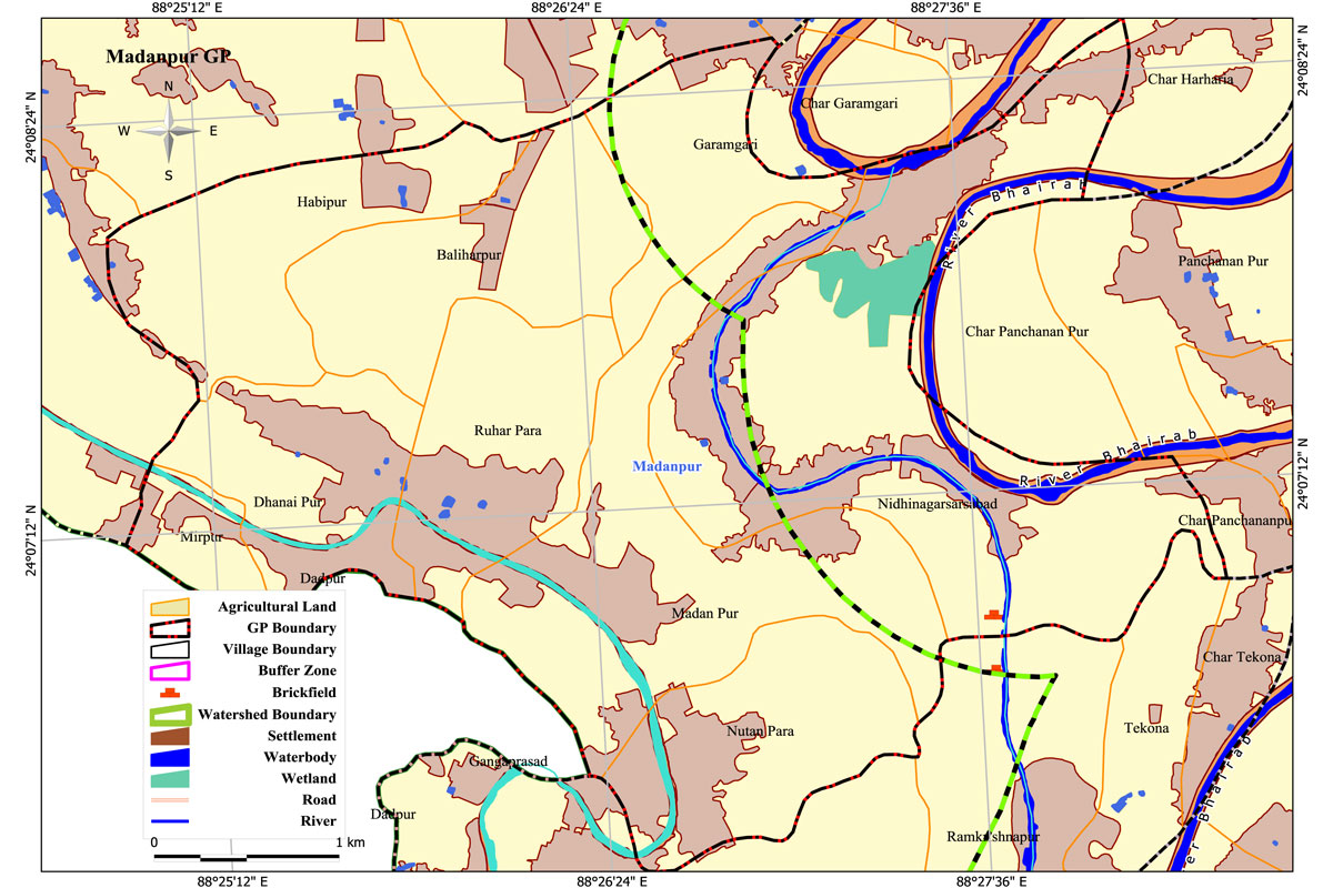
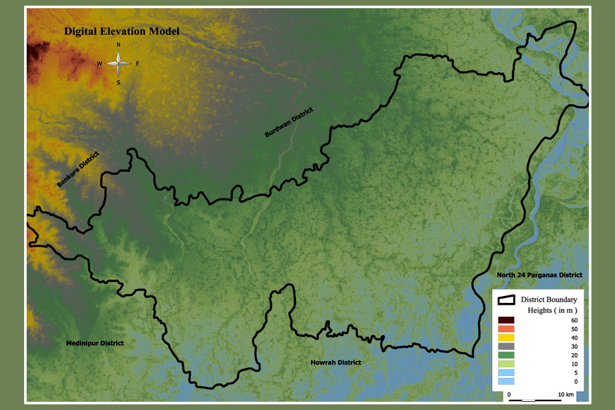
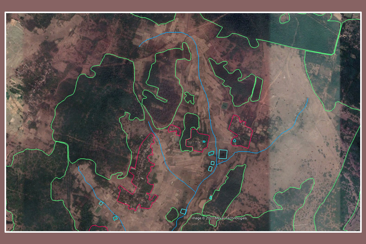
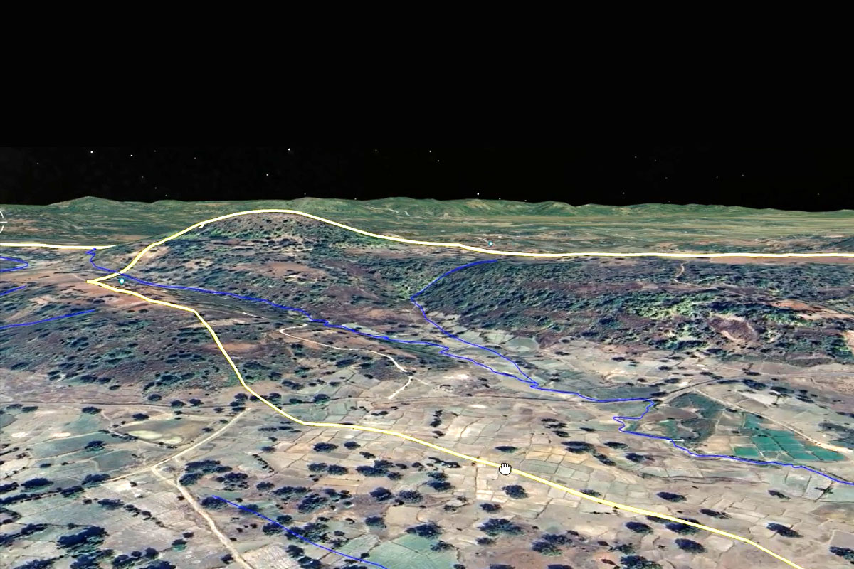
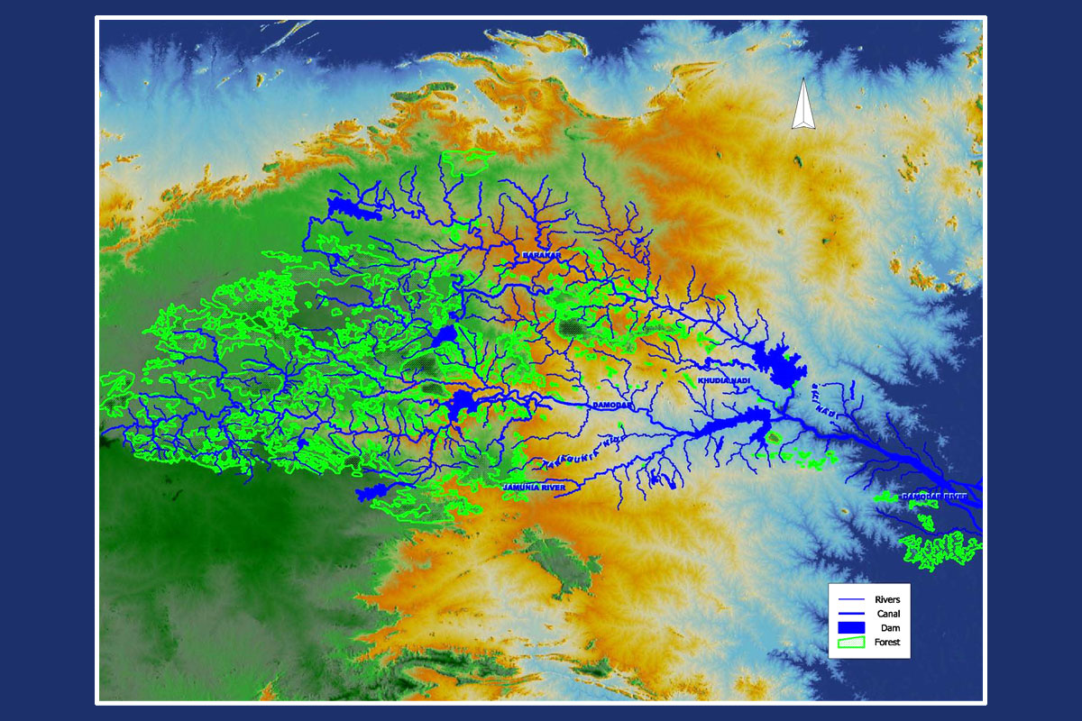
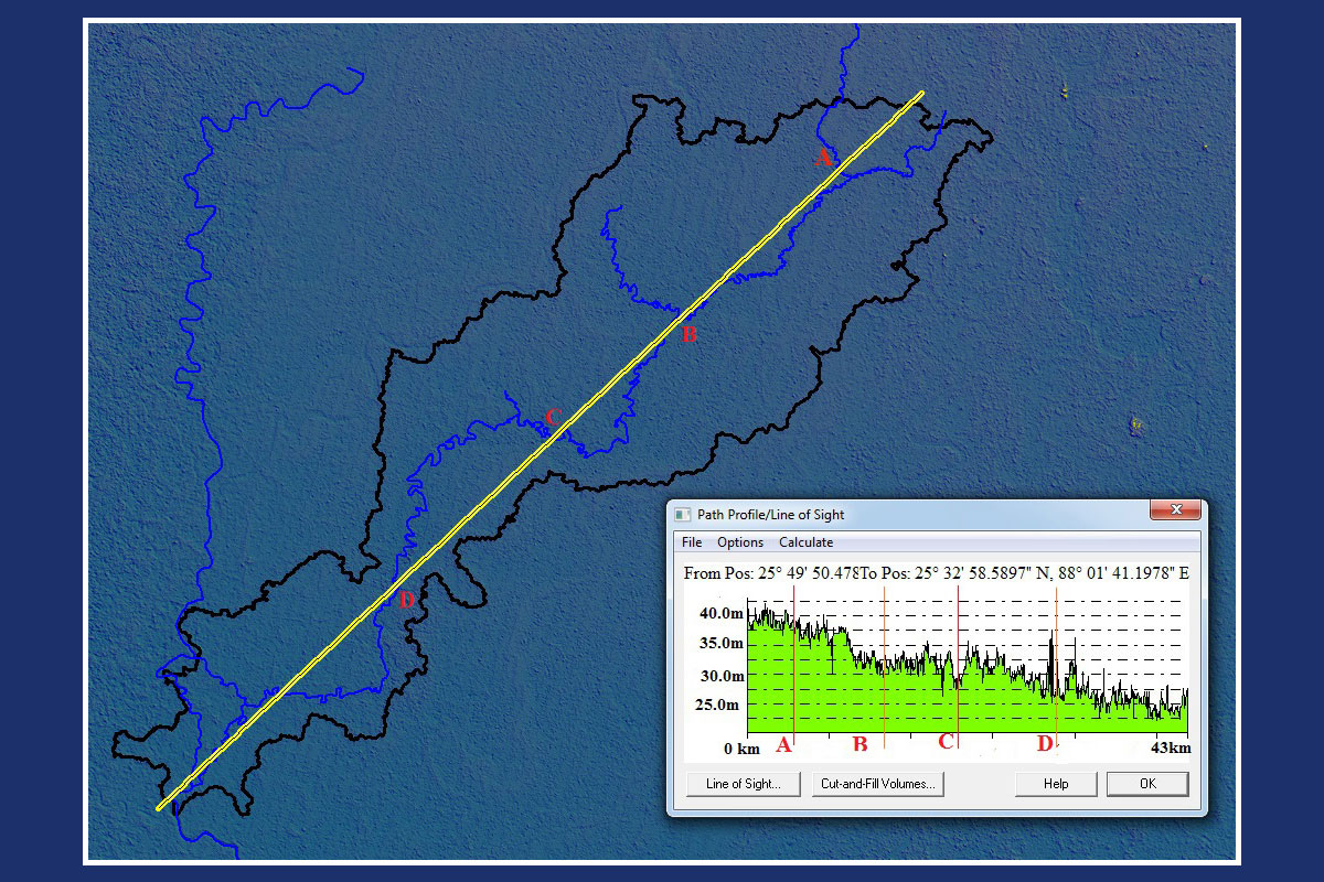
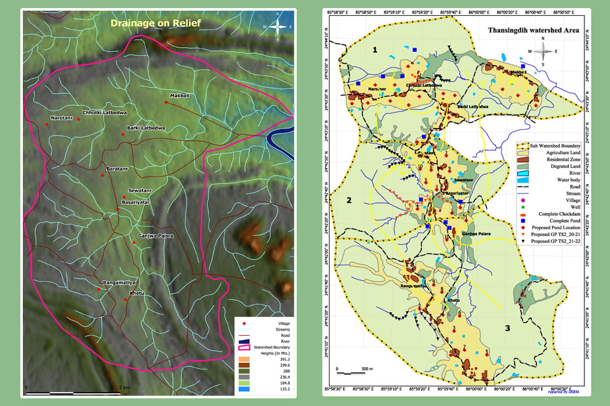
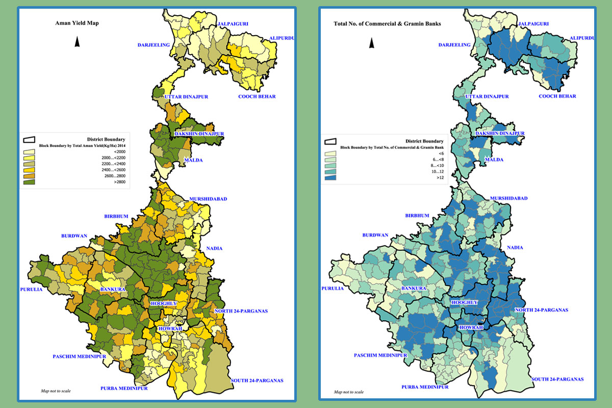
Geoinformatics & Remote Sensing Services
With very sound technical knowledge and experienced multidisciplinary team of professionals. PAN has gained a strong foothold in Geo-informatics and Geo-Science fields. Supported by up to date software and hardware PAN team has been working in Satellite Image Interpretation, data collection, analysis in the application areas on Environment Science, Hydrogeology, Geology, Soil Science, Photogrammetry, Surveying, Urban & Rural Planning, Transport, Economic & Business modelling. The workload being dealt with by our expert team includes creation of GIS database, Map Digitisation, Decision Support System, Customisation, GPS services, Total Station Survey and Mapping, preparation of CAD Engineering drawing, contour mapping & traversing etc.
Remote Sensing Services
PAN professionals regularly utilise commercial as well as open source remote sensing satellite images for geo-rectification, ortho-rectification processes, and accurate interpretation to generate seamless quality raster data products from multiple image tiles.
PAN’s remote sensing services include: